


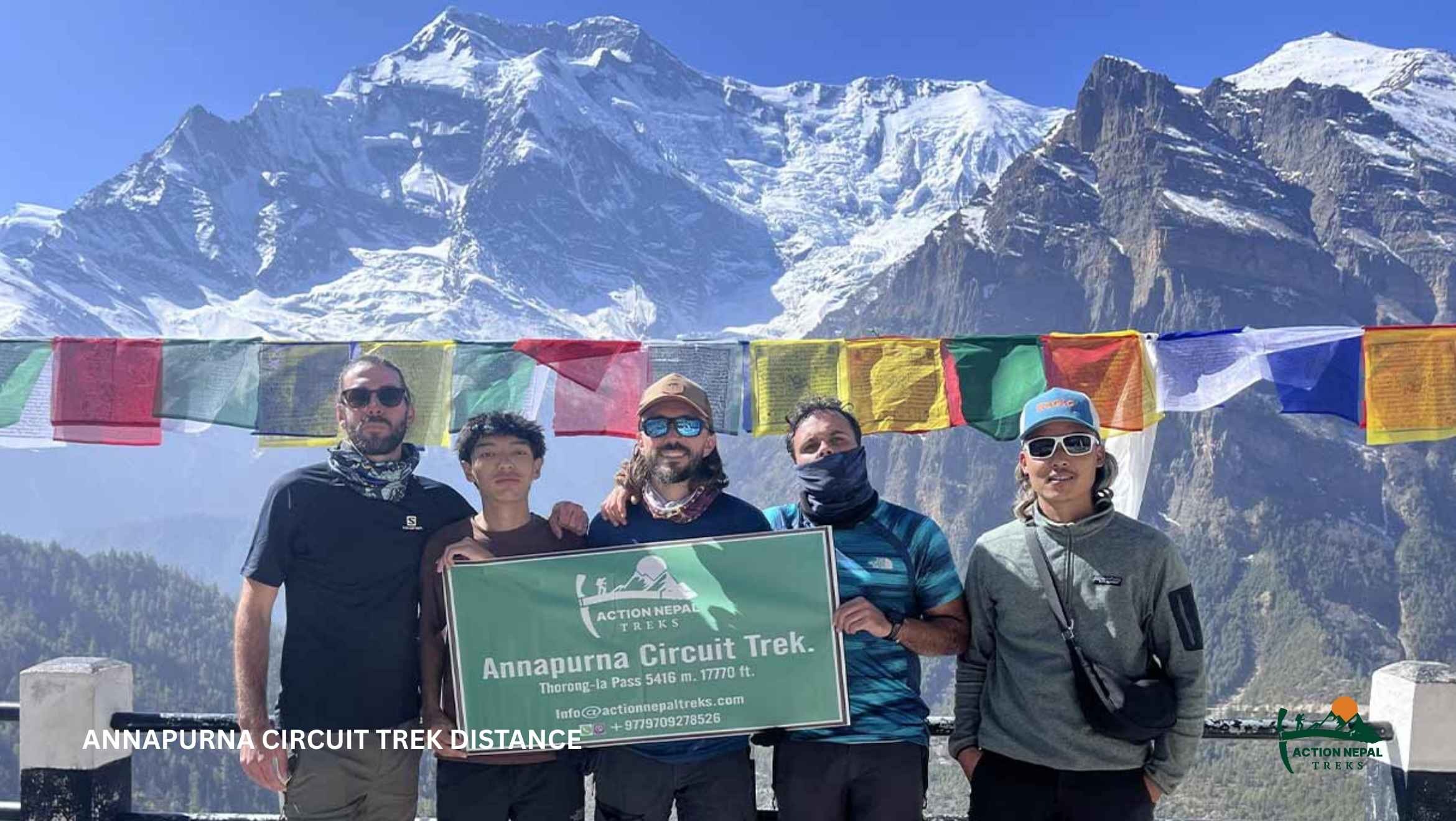
The total Annapurna Circuit Trek distance ranges from 160 km to 230 km (100-145 miles), depending on your itinerary, route choices, side trips, and whether you use local jeeps to bypass road sections. Road development has made the trek highly flexible, allowing some trekkers to complete it in 10-14 days while others follow the traditional 18-21 day route. Despite the long distance, daily walking stages are usually manageable. Elevation gain is gradual and supports steady acclimatization.
The route passes through an extraordinary range of landscapes and cultures. It starts in subtropical valleys with terraced farms and forests, then gradually climbs into alpine terrain and the dry, Tibetan-influenced landscapes beyond Thorong La Pass. You’ll witness traditional villages, Buddhist monasteries, prayer wheels, and suspension bridges, while views of the Annapurna Massif and Dhaulagiri remain a constant presence. Each day brings noticeable changes in scenery, making the trek feel like a journey across multiple regions rather than a single long-distance hike.
Quick Facts About the Annapurna Circuit Trek and Its Distance
| Key Metric | Details & Specifications |
|---|---|
| Total Walking Distance | 160 km to 230 km (100 to 145 miles) |
| Average Daily Distance | 10 km to 15 km (6 to 9 miles) |
| Average Walking Time | 5 to 7 hours per day |
| Trek Duration | 8 to 22 days (based on jeep choices) |
| Highest Altitude Point | Thorong La Pass at 5,416m (17,769 ft) |
| Longest Trekking Day | Pass Day (15-17 km/8 to 10 hours) |
| Shortest Trekking Days | Acclimatization day in Manang (5-8 km) |
| Trail Start Points | Besisahar, Dharapani, or Chame |
| Trail End Points | Jomsom, Tatopani, or Nayapul |
| Popular Side Trips | Tilicho Lake: Adds approx. 30 km (18.6 miles) Nar Phu Valley: Adds approx. 45 km (28 miles) Poon Hill: Adds approx. 75 km (46.6 miles) |
How does the Annapurna Circuit Trek Distance vary by Itinerary Length
The distance varies based on your Annapurna Circuit Trek itinerary because each has different starting points, ending points, and side trips, which can significantly change the trekking route. Roads now reach Manang itself and even deeper in Khangsar. So, you can directly take a jeep there and skip certain sections without missing major highlights. Alternatively, you can also add side trips to nearby routes like Nar Phu Valley, Tilicho Lake, and Poon Hill. As a result, itineraries can range from a shorter 8-14-day trek to the traditional 18-22-day circuit.
Classical Annapurna Circuit Trek

The Classic Annapurna Circuit Trek follows the original full-route style. It starts officially from Besisahar and is entirely on foot through Bhulbhule, Chamje, Dharapani, and Chame. You reach Manang (3,540 m/11,614 ft) on day seven of the trek. From there, the route continues through Yak Kharka and Thorong Phedi, eventually crossing Thorong La Pass (5,416 m/17,769 ft) and descending to Jomsom.
Modern ACT versions skip the entire lower valley section with jeep shortcuts or road transfers, but on the classic route, you trek through. This keeps the ascent gradual and preserves the full cultural and landscape transition from lowland villages to high alpine terrain.
| Day | Route | Starting Altitude | Ending Altitude | Approx. Distance | Walking Time | Difficulty | Highlights |
|---|---|---|---|---|---|---|---|
| 1 | Drive from Kathmandu to Besisahar and trek to Bhulbhule | 1,400 m (4,593 ft) | 840 m (2,756 ft) | 9 km (5.6 mi) | 3-4 hrs | Easy | Terraced fields, Marshyangdi River, rural villages |
| 2 | Bhulbhule to Chamje | 840 m (2,756 ft) | 1,430 m (4,691 ft) | 16 km (9.9 mi) | 5-6 hrs | Moderate | Waterfalls, river gorges, stone teahouses |
| 3 | Chamje to Dharapani | 1,430 m (4,691 ft) | 1,860 m (6,102 ft) | 15 km (9.3 mi) | 5-6 hrs | Moderate | Entering Manang district, mani walls, farmland |
| 4 | Dharapani to Chame | 1,860 m (6,102 ft) | 2,670 m (8,760 ft) | 16 km (9.9 mi) | 5-6 hrs | Moderate | Pine forests, first views of Annapurna II |
| 5 | Chame to Upper Pisang | 2,670 m (8,760 ft) | 3,200 m (10,827 ft) | 14 km (8.7 mi) | 5-6 hrs | Moderate | Rock walls, apple orchards, mountain views |
| 6 | Upper Pisang to Ngawal | 3,300 m (10,827 ft) | 3,660 m (12,008 ft) | 10 km (6.2 mi) | 4-5 hrs | Strenuous | Tibetan villages, wide Annapurna panoramas |
| 7 | Ngawal to Manang | 3,660 m (12,008 ft) | 3,540 m (11,614 ft) | 10 km (6.2 mi) | 4 hrs | Easy | Braga Monastery, valley descent |
| 8 | Acclimatization day in Manang | 3,540 m (11,614 ft) | 3,540 m (11,614 ft) | – | – | Easy | Ice Lake hike, glacier viewpoints |
| 9 | Manang to Yak Kharka | 3,540 m (11,614 ft) | 4,000 m (13,123 ft) | 10 km (6.2 mi) | 4-5 hrs | Moderate | Alpine terrain, yaks, blue sheep |
| 10 | Yak Kharka to Thorong Phedi | 4,000 m (13,123 ft) | 4,450 m (14,600 ft) | 8 km (5 mi) | 4-5 hrs | Moderate | High-altitude landscapes, river crossings |
| 11 | Thorong Phedi to Muktinath via Thorong La Pass | 4,450 m (14,600 ft) | 3,760 m (12,336 ft) | 16 km (9.9 mi) | 8-9 hrs | Strenuous | Thorong La Pass, prayer flags, sacred temples |
| 12 | Muktinath to Jomsom | 3,760 m (12,336 ft) | 2,720 m (8,924 ft) | 18 km (11.2 mi) | 5-6 hrs | Moderate | Kali Gandaki Valley, Kagbeni village |
| 13 | Jomsom to Pokhara (Fly or Drive) | 2,720 m (8,924 ft) | 810 m (2,657 ft) | 160 km (99 mi) | 25 min flight/7 hrs drive | Easy | Mountain flight or jeep ride, lakeside finish |
Short Annapurna Circuit Trek

The Short Annapurna Circuit Trek is a compact 8-day version of the classic route. This one covers about 73 km of active trekking distance by skipping the lower valley sections through jeep access. Instead of starting on foot from Besisahar, the journey begins in Chame (2,670 m/8,760 ft), where the real high-altitude trail starts. From here, you climb steadily through alpine forests, traditional Tibetan-influenced villages, and wide mountain valleys before Thorong La Pass, the highest point of the circuit.
This version is designed for trekkers who want the core Annapurna experience in less time without losing the major highlights. It still includes Manang, the rest day, and an acclimatization hike to Gangapurna Lake or Chongkor viewpoint, the dramatic pass crossing, and the spiritual stop at Muktinath. It only removes the long, unnecessary walking days.
The result is a faster, more direct journey into the high Himalayas, focusing on scenery, altitude, and cultural depth in a tight itinerary below.
| Day | Route | Starting Altitude | Ending Altitude | Approx. Distance | Walking Time | Difficulty | Highlights |
|---|---|---|---|---|---|---|---|
| 1 | Drive from Kathmandu to Besisahar, then jeep to Chame | 1,400 m (4,593 ft) | 2,670 m (8,760 ft) | – | Drive only | Easy | Scenic highway, waterfalls, entry into the Manang region |
| 2 | Chame to Upper Pisang | 2,670 m (8,760 ft) | 3,200 m (10,499 ft) | 15 km (9.3 mi) | 5-6 hrs | Moderate | Paungda Danda rock face, pine forests, mountain views |
| 3 | Upper Pisang to Manang (via Ghyaru and Ngawal) | 3,200 m (10,499 ft) | 3,540 m (11,614 ft) | 17 km (10.6 mi) | 7-8 hrs | Moderate | Tibetan villages, Annapurna III views |
| 4 | Acclimatization day in Manang | 3,540 m (11,614 ft) | 3,540 m (11,614 ft) | 4-6 km (2.5-3.7 mi) | 2-3 hrs | Easy | Gangapurna Lake, monastery hikes |
| 5 | Manang to Yak Kharka | 3,540 m (11,614 ft) | 4,050 m (13,287 ft) | 10 km (6.2 mi) | 4-5 hrs | Moderate | Alpine terrain, yak pastures |
| 6 | Yak Kharka to High Camp | 4,050 m (13,287 ft) | 4,800 m (15,748 ft) | 7.8 km (4.8 mi) | 4 hrs | Strenuous | High-altitude ascent, final push preparation |
| 7 | High Camp to Thorong La Pass to Muktinath | 4,800 m (15,748 ft) | 3,800 m (12,467 ft) | 14 km (8.7 mi) | 7-8 hrs | Challenging | Thorong La Pass, prayer flags, Muktinath temple |
| 8 | Drive from Muktinath to Pokhara | 3,800 m (12,467 ft) | 820 m (2,690 ft) | – | Drive only | Easy | Kali Gandaki Gorge, Jomsom, hot springs |


Annapurna Circuit Trek with Tilicho Lake

The Annapurna Circuit with the Tilicho Lake extension covers approximately 190 km (118.6 miles), around 30 km (18.6 miles) more than the standard route. The side trip branches off near Manang, passes through Tilicho Base Camp, leads you to the glacial lake at 4,919 m (16,138 ft), and then rejoins the main circuit before the climb toward Thorong La Pass.
That extra distance takes you away from the main trekking corridor and into a quieter, more rugged part of the Annapurna region. The trail becomes steeper and more remote, with fewer villages and facilities along the way. In return, you get to stand beside the deep blue waters of Tilicho Lake, surrounded by towering peaks and high-altitude landscapes that feel very different from the rest of the circuit.
Here’s a table breakdown of our Annapurna Circuit Trek with Tilicho Lake side trip to help you understand how it changes the itinerary, distance, and overall experience.
| Day | Route | Start Altitude | End Altitude | Distance | Walking Time | Difficulty | Highlights |
|---|---|---|---|---|---|---|---|
| 1 | Drive from Kathmandu to Besisahar to Chame | 1,400 m (4,593 ft) | 2,670 m (8,760 ft) | – | Drive only | Easy | Scenic mountain roads, waterfalls, pine forests around Chame |
| 2 | Chame to Upper Pisang | 2,670 m (8,760 ft) | 3,200 m (10,499 ft) | 15 km (9.3 mi) | 5-6 hrs | Moderate | Paungda Danda rock face, pine forests, valley views |
| 3 | Upper Pisang to Manang (via Ghyaru and Ngawal) | 3,200 m (10,499 ft) | 3,540 m (11,614 ft) | 17 km (10.6 mi) | 7-8 hrs | Moderate | Annapurna III views, Tibetan-style villages |
| 4 | Acclimatization Day in Manang | 3,540 m (11,614 ft) | 3,540 m (11,614 ft) | 4-6 km (2.5-3.7 mi) | 2-3 hrs | Easy | Gangapurna Lake, Chongkor Viewpoint, monasteries |
| 5 | Manang to Tilicho Base Camp | 3,540 m (11,614 ft) | 4,150 m (13,615 ft) | 11 km (6.8 mi) | 4-5 hrs | Moderate | Side trip toward Tilicho Lake, mountain scenery |
| 6 | Tilicho Lake and return to Shree Kharka | 4,150 m (13,615 ft) | 4,060 m (13,320 ft) | 18 km (11.2 mi) | 7-8 hrs | Challenging | Tilicho Lake (4,919 m/16,138 ft), glacial landscapes |
| 7 | Shree Kharka to Ledar | 4,060 m (13,320 ft) | 4,200 m (13,780 ft) | 12 km (7.5 mi) | 4-5 hrs | Moderate | Alpine terrain, Annapurna range views |
| 8 | Ledar to High Camp | 4,200 m (13,780 ft) | 4,800 m (15,748 ft) | 7.8 km (4.8 mi) | 4 hrs | Strenuous | High-altitude landscapes, Thorong La approach |
| 9 | High Camp to Thorong La Pass to Muktinath | 4,800 m (15,748 ft) | 3,800 m (12,467 ft) | 14 km (8.7 mi) | 7-8 hrs | Challenging | Thorong La Pass (5,416 m/17,769 ft), prayer flags, Muktinath Temple |
| 10 | Drive from Muktinath to Pokhara | 3,800 m (12,467 ft) | 820 m (2,690 ft) | – | Drive only | Easy | Kali Gandaki Gorge, Jomsom, Tatopani |
Annapurna Circuit Trek via Poon Hill

The Annapurna Circuit Trek via Poon Hill covers approximately 148 km (92 miles) of trekking over 12 days. It follows the classic Annapurna Circuit through Manang and across Thorong La Pass, but instead of returning directly to Jomsom, it continues south to Tatopani, Ghorepani, and Poon Hill for one of Nepal’s most popular sunrise viewpoints.
The extension adds both distance and variety, combining high-altitude trekking with lower-elevation forest trails and panoramic views of Dhaulagiri, Annapurna South, and Machhapuchhre.
| Day | Route | Starting Altitude | Ending Altitude | Approx. Distance | Walking Time | Difficulty | Highlights |
|---|---|---|---|---|---|---|---|
| 1 | Drive from Kathmandu to Besisahar, then jeep to Jagat | 1,400 m (4,593 ft) | 1,300 m (4,265 ft) | – | Drive only | Easy | Mountain highway, river valleys, remote villages |
| 2 | Jagat to Dharapani | 1,300 m (4,265 ft) | 1,860 m (6,102 ft) | 15 km (9.3 mi) | 6-7 hrs | Moderate | Suspension bridges, waterfalls, Marsyangdi Gorge |
| 3 | Dharapani to Chame | 1,860 m (6,102 ft) | 2,610 m (8,563 ft) | 16 km (9.9 mi) | 6-7 hrs | Moderate | Pine forests, Annapurna II views |
| 4 | Chame to Upper Pisang | 2,610 m (8,563 ft) | 3,200 m (10,499 ft) | 13.6 km (8.5 mi) | 5-6 hrs | Moderate | Paungda Danda, alpine forests |
| 5 | Upper Pisang to Manang | 3,200 m (10,499 ft) | 3,540 m (11,614 ft) | 17 km (10.6 mi) | 7-8 hrs | Moderate | Ghyaru, Ngawal, Annapurna panoramas |
| 6 | Acclimatization day in Manang | 3,540 m (11,614 ft) | 3,540 m (11,614 ft) | 4-6 km (2.5-3.7 mi) | 2-3 hrs | Easy | Gangapurna Lake, monasteries |
| 7 | Manang to Yak Kharka | 3,540 m (11,614 ft) | 4,200 m (13,780 ft) | 12 km (7.5 mi) | 4-5 hrs | Moderate | Alpine meadows, yak pastures |
| 8 | Yak Kharka to High Camp | 4,200 m (13,780 ft) | 4,925 m (16,158 ft) | 7.8 km (4.8 mi) | 4 hrs | Strenuous | High-altitude ascent |
| 9 | High Camp to Thorong La Pass to Muktinath | 4,925 m (16,158 ft) | 3,800 m (12,467 ft) | 14 km (8.7 mi) | 7-8 hrs | Challenging | Thorong La Pass |
| 10 | Drive from Muktinath to Tatopani | 3,800 m (12,467 ft) | 1,190 m (3,904 ft) | – | 4-5 hrs drive | Easy | Kali Gandaki Gorge, hot springs |
| 11 | Tatopani to Ghorepani | 1,190 m (3,904 ft) | 2,860 m (9,383 ft) | 17 km (10.6 mi) | 6-7 hrs | Strenuous | Rhododendron forests, mountain villages |
| 12 | Poon Hill sunrise, trek to Nayapul, drive to Pokhara | 2,860 m (9,383 ft) | 1,070 m (3,510 ft) | 10 km (6.2 mi) | 4-5 hrs | Moderate | Poon Hill, Annapurna, and Dhaulagiri views |
Annapurna Circuit Trek via Nar Phu

The Annapurna Circuit Trek via Nar Phu Valley covers approximately 112 km (70 miles) of trekking over 13 days. It leaves the main Annapurna Circuit at Koto, explores the remote Nar Phu region, crosses Kang La Pass, and then rejoins the circuit before crossing Thorong La Pass.
This route stands out for its restricted valley, fewer trekkers, traditional Tibetan settlements, and two passes above 5,000 m. It is generally considered the most remote and culturally distinct variation of the Annapurna Circuit.
| Day | Route | Starting Altitude | Ending Altitude | Approx. Distance | Walking Time | Difficulty | Highlights |
|---|---|---|---|---|---|---|---|
| 1 | Drive from Kathmandu to Besisahar, then jeep to Koto | 1,400 m (4,593 ft) | 2,610 m (8,563 ft) | – | Drive only | Easy | Marsyangdi Valley, remote villages |
| 2 | Koto to Meta | 2,610 m (8,563 ft) | 3,560 m (11,680 ft) | 14 km (8.7 mi) | 6-7 hrs | Moderate | Pine forests, narrow canyons |
| 3 | Meta to Phu | 3,560 m (11,680 ft) | 4,255 m (13,960 ft) | 16 km (9.9 mi) | 6-7 hrs | Strenuous | Chortens, high mountain scenery |
| 4 | Acclimatization day in Phu | 4,255 m (13,960 ft) | 4,255 m (13,960 ft) | 4-5 km (2.5-3.1 mi) | 2-3 hrs | Easy | Tashi Lhakhang Monastery |
| 5 | Phu to Naar Phedi | 4,255 m (13,960 ft) | 3,750 m (12,303 ft) | 16 km (9.9 mi) | 6-7 hrs | Moderate | Remote valleys, monasteries |
| 6 | Naar Phedi to Naar Village | 3,750 m (12,303 ft) | 4,200 m (13,780 ft) | 5 km (3.1 mi) | 3-4 hrs | Moderate | Traditional Tibetan settlement |
| 7 | Naar Village to Kang La Pass to Ngawal | 4,200 m (13,780 ft) | 3,660 m (12,008 ft) | 17 km (10.6 mi) | 7-8 hrs | Challenging | Kang La Pass |
| 8 | Ngawal to Manang | 3,660 m (12,008 ft) | 3,540 m (11,614 ft) | 8.9 km (5.5 mi) | 3-4 hrs | Moderate | Forest trails, alpine meadows |
| 9 | Acclimatization day in Manang | 3,540 m (11,614 ft) | 3,540 m (11,614 ft) | 4-6 km (2.5-3.7 mi) | 2-3 hrs | Easy | Viewpoints, local culture |
| 10 | Manang to Yak Kharka | 3,540 m (11,614 ft) | 4,200 m (13,780 ft) | 12 km (7.5 mi) | 4-5 hrs | Moderate | Open alpine terrain |
| 11 | Yak Kharka to High Camp | 4,200 m (13,780 ft) | 4,800 m (15,748 ft) | 7.8 km (4.8 mi) | 4 hrs | Strenuous | High-altitude ascent |
| 12 | High Camp to Thorong La Pass to Muktinath | 4,800 m (15,748 ft) | 3,800 m (12,467 ft) | 14 km (8.7 mi) | 7-8 hrs | Challenging | Thorong La Pass |
| 13 | Drive from Muktinath to Pokhara | 3,800 m (12,467 ft) | 820 m (2,690 ft) | – | Drive only | Easy | Kali Gandaki Gorge, Mustang scenery |
What Factors Can Change Your Total Trekking Distance
The Annapurna Circuit trek route varies depending on five main factors: jeep road usage, NATT trail choices, route and navigation decisions, seasonal trail detours caused by landslides or weather, and altitude-related descents for acclimatization or recovery from Acute Mountain Sickness (AMS).
Jeep Transport and Road Access
Dirt roads now reach deep into the circuit, allowing trekkers to skip long sections by jeep up to Khangsar. Starting from Dharapani or Chame instead of Besisahar can reduce the walking distance considerably, while ending at Muktinath or Jomsom shortens the route further. Using road transport can reduce the active trekking distance to roughly 85-100 km (53-62 miles).
NATT Trails
The Natural Annapurna Trekking Trails (NATT) network was created to keep trekkers off vehicle roads. Marked with red-and-white or blue-and-white trail markers, these routes pass through forests, villages, suspension bridges, and ridgelines. They are often longer than the jeep roads but provide a more scenic and traditional trekking experience.
Route Choices and Navigation
Different trail options, including your starting and ending points and your trail selection, can slightly change the total distance. For example, the upper route through Upper Pisang and Ngawal is longer than the lower valley trail but offers better views and acclimatization. And if you’re an independent trekker, you may also add a few extra kilometers if you miss junctions or need to backtrack. (Yes, the Annapurna Circuit allows independent trekking as long as you have an Annapurna Conservation Area Permit.)
Landslides and Trail Detours
Monsoon rains, snowmelt, and erosion can occasionally damage trails or suspension bridges. When this happens, you may need to follow temporary detours around affected areas, adding extra distance and elevation gain to the itinerary.
Altitude Sickness and Acclimatization
Altitude-related issues can also affect the distance covered. If symptoms of Acute Mountain Sickness (AMS) develop near places such as Manang or Yak Kharka, you may need to descend to a lower altitude before continuing. These safety-related detours add extra walking distance but are necessary for proper acclimatization and recovery.


How Start and End Point Changes the Total Distance
As you already know, the biggest factors affecting the total Annapurna Circuit Trek distance are where you start and finish walking. With road access now deep into the circuit, trekkers can skip sections by jeep or extend the journey by continuing beyond the usual exit points.
Starting Points
- Besisahar (Classic Start): The traditional starting point that includes the entire lower-valley section and the longest trekking distance.
- Dharapani: Cuts roughly 35 km (22 miles) from the route by skipping the trail between Besisahar and Dharapani.
- Chame: Cuts roughly 65 km (40 miles) from the route by bypassing most of the lower valley trekking.
Ending Points
- Muktinath (Shortest Option): Ends the trek immediately after crossing Thorong La Pass, reducing the route by around 60 km (37 miles) compared to the full circuit.
- Jomsom (Standard Exit): A common finishing point that shortens the trek by about 45 km (28 miles).
- Tatopani: Adds approximately 30 km (18.6 miles) of walking beyond Jomsom through the Kali Gandaki Valley.
- Nayapul (via Poon Hill): Adds approximately 60 km (37 miles) beyond Jomsom, extending the trek through Ghorepani and Poon Hill before finishing near Pokhara.
In general, starting farther along the circuit reduces the total distance, while continuing past Jomsom increases it. You can choose any of the options according to your holiday window. Annapurna Circuit is that flexible.
How Does Daily Walking Distance Relate to Trek Difficulty and Fitness
On the Annapurna Circuit, altitude and terrain matter more than distance alone. A 10 km walk at 4,000 m (13,123 ft) feels far more demanding than the same distance in the lower valleys because thinner air reduces oxygen levels and increases fatigue.
Annapurna Circuit Trek Distance vs Altitude Challenge
As elevation increases, itineraries naturally reduce daily travel distances. We do this because even if trekkers often cover 15-17 km (9-11 miles) per day between Besisahar and Chame, they only cover 8-10 km (5-6 miles) per day above 3,000 m (9,843 ft). At this height, atmospheric pressure drops, and you receive roughly 30% less oxygen per breath than you do at sea level. This slower pace helps manage physical strain and supports proper acclimatization.
Why Is the Thorong La Pass Crossing the Longest and Hardest Day of the Trek
The crossing of Thorong La Pass is the longest and most demanding day of the trek journey. You cover 15-17 km (9-11 miles) over 8-10 hours on this day alone. The day begins before sunrise, often around 4:00-5:00 AM, to get an early start and avoid strong afternoon winds near the pass. From High Camp, you need to climb nearly 900 m (2,953 ft) to the summit of Thorong La Pass at 5,416 m (17,769 ft), where thin air and lower oxygen levels make every step feel more demanding.

Even after reaching the pass, the challenge is far from over. The route then drops by about 1,600 m (5,249 ft) over rocky, uneven terrain to Muktinath. Combined with cold morning temperatures, changing weather conditions, and the lack of teahouses or easy exit points along the route, this makes pass day the toughest stage of the trek on the Annapurna Circuit.
Can Beginners Complete the Annapurna Circuit Trek
Yes. The Annapurna Circuit is suitable for beginners with reasonable fitness and adequate preparation. You don’t need technical climbing skills or specialized equipment for this trek. The biggest challenge for most trekkers is not the distance itself, but adapting to the altitude while maintaining a steady pace over multiple days.
You can do a few things to improve your chances of success, such as:
- Build cardio and leg endurance through hiking, stair climbing, cycling, or running before the trek.
- Take acclimatization hikes. They are optional, but don’t treat the acclimatization day in Manang as a rest day. Only skip if you’re experiencing AMS symptoms.
- Use trekking poles to reduce strain on descents.
- Consider hiring a guide or porter for additional support and safety.
What Is the Best Time for the Annapurna Circuit Trek, and How Does It Affect Route Distance
The best time to trek the Annapurna Circuit is during Autumn (September to November) and Spring (March to May). These are the peak seasons when weather conditions are stable, trails are open, and the standard 160-230 km (100-145 miles) trekking distance can usually be completed without disruptions.
Peak Seasons: Stable and Predictable Routes
Autumn (September to November) is considered the ideal window, especially October. Skies are clear, rainfall is minimal, and snow risks are low, which keeps the full route open from the lower valleys to Thorong La Pass.
Spring (March to May) is also excellent, with warmer temperatures and rhododendron blooms across the lower and mid-hills. While some snow may still linger at higher elevations, the trail remains mostly stable and predictable.
How Off-Seasons Affect the Route and Distance
In winter (December to February), heavy snowfall above ~4,500 m can temporarily close Thorong La Pass. When this happens, trekkers may need to reroute, wait for clearance, or descend the same way back, which effectively increases walking distance and time due to backtracking and delays.
Similarly, during the monsoon (June to August), heavy rain can affect the lower sections of the trail. Landslides, slippery paths, and washed-out bridges can force emergency detours onto higher ridges or alternative paths. These reroutes often add extra kilometers and more elevation gain, making the trek slower and more physically demanding, even if the planned route distance stays the same.
Annapurna Circuit vs Annapurna Sanctuary Distance
The Annapurna Circuit and Annapurna Sanctuary or Annapurna Base Camp Trek are the two most popular treks in the Annapurna region, but they offer very different experiences. The Circuit is a long-distance journey that circles the entire Annapurna Massif, crossing multiple valleys, ecological zones, and a high mountain pass. The Sanctuary, on the other hand, is a shorter trek that leads directly into a natural glacial basin surrounded by towering peaks.
| Trek | Approx. Distance | Duration | Walking Hours/Day | Maximum Altitude | Difficulty | Terrain |
|---|---|---|---|---|---|---|
| Annapurna Circuit Trek | 160-230 km (100-145 mi) | 8-22 days | 5-8 hrs | 5,416 m / 17,769 ft (Thorong La Pass) | Moderate to Challenging | Subtropical valleys, river gorges, alpine forests, high-altitude desert |
| Annapurna Sanctuary Trek | 110-120 km (68-75 mi) | 7-12 days | 5-7 hrs | 4,130 m / 13,549 ft (Annapurna Base Camp) | Moderate | Rhododendron forests, glacial moraines, alpine basin |
Conclusion
The Annapurna Circuit Trek distance is not fixed. It changes with your starting point, route choices, side trips, and use of transport. It ranges from about 73 km on shortened versions to over 200 km on the full circuit, but all routes include the crossing of Thorong La Pass and the main valley-to-high-pass-to-descent progression.
Choose the distance based on your available days and fitness level. Shorter routes focus on the high-altitude section, while longer ones include the full lower valleys and cultural transition. Trouble planning your itinerary? Use our trip planner for your Annapurna Circuit Trek with a route that matches your pace and goals.

