Sambir
Connect With a Trek Expert(Simbir) +977 9709278526

Manaslu Tsum Valley Trek

Mountain Icon

Max. Altitude

5,106m /16,752ft

Duration Icon

Duration

17 Days

Grade Icon

Grade

Demanding
Activity Icon

Activity

Trekking

Season Icon

Best Season

Spring (Mar, Apr, May), Autumn (Sept, Oct, Nov)

Transportation Icon

Transportation

Local Bus

Meals Icon

Meals Included

Breakfast, Lunch, Dinner
Region Icon

Trek Region

Manaslu Region Trek Packages

Destination Icon

Destination

Tours & Treks in Nepal

Destination Icon

Group Size

2 - 15

Activity Icon

Activity Per Day

6 Hours

Start End Icon

Start/End Point

Kathmandu/Kathmandu

Nature Icon

Nature Of Trek

Lodge to Lodge

Manaslu Tsum Valley Trek Overview

The 17 days Manaslu Tsum Valley Trek is a highly unique, visually stunning, and culturally rich trek in Nepal. It takes you through the remote Manaslu region near the Tibetan border. The route takes you to the peaceful Tsum Valley and along the Manaslu Circuit, known for its Buddhist culture, traditional villages, mountain views, and the challenging Larkya Pass at 5,106m /16,752ft.

The trek begins with a drive from Kathmandu to Machha Khola. From there, you walk along the Budhi Gandaki River toward Jagat and Lokpa. The trail then enters Tsum Valley and passes through Chumling, Chhekamparo, and Nile. You also get a day to visit Mu Gompa and Anni Gompa before returning to Chumling and joining the Manaslu Circuit at Deng.

From Deng, the trail climbs through Namrung to Samagaun, where you have an acclimatization day with breathtaking views of Mount Manaslu. You then continue to Samdo and Dharmasala before crossing Larkya Pass, the trek’s highest point. The trail then descends to Bhimtang and Tilche before the drive from Besisahar to Kathmandu.

Overall, this trek brings together mountain scenery, Buddhist culture, remote villages, and high-altitude trails in one journey. It is a good choice for trekkers who want to explore both Tsum Valley and the Manaslu Circuit on the same trip.

Manaslu Tsum Valley Trek Itinerary

Day 1: Drive From Kathmandu to Machha Khola

Your journey starts early in Kathmandu. Your guide meets you at your hotel before you leave the city by local bus. The road follows the Prithvi Highway out of the Kathmandu Valley, passing green hills, terraced fields, small roadside settlements, and deep river valleys. Around midday, the paved road gives way to gravel and rough tracks near Arughat. From here, the ride becomes noticeably bumpier as the bus moves over rocky sections, with the Budhi Gandaki River appearing alongside the road.

The final stretch follows the river gorge toward Machha Khola, the starting point of the trek. It is a small settlement in a warm, subtropical setting with thick vegetation around the river. Once you check into your local lodge, you have time to rest, stretch your legs, and organize your trekking gear. Dinner is served in the communal dining area before you settle in for the night.

Itinerary Details
Itinerary Fact Details
Meals Icon
Meals
Breakfast, Lunch, Dinner
Accommodation Icon
Accommodation
Teahouse
Mountain Icon
Highest Altitude
930 m (3050 ft)
Duration Icon
Trek Duration
7-8 hours
Duration Icon
Drive Duration
160 km (99 miles)

Day 2: Trek From Machha Khola to Jagat

The Manaslu Circuit and Tsum Valley trekking trail starts from Machha Khola. It follows the canyon, with the river nearby for most of the morning. You cross a long steel suspension bridge over the Machha Khola and continue along stone steps, sandy riverbanks, and short climbs. At Tatopani, you pass natural hot springs where steam rises from the rocks, and you may notice a light smell of sulfur.

After Tatopani, the gorge gets narrower, and the cliffs rise. The trail passes through bamboo forests, with cicadas and the river along the way. You’ll see mule trains carrying supplies. Stay toward the wall when they pass. A final climb up stone steps takes you into Jagat, where you find flagstone paths and nearby potato and maize fields. After checking into your lodge, you can relax with some ginger tea.

Itinerary Details
Itinerary Fact Details
Meals Icon
Meals
Breakfast, Lunch, Dinner
Accommodation Icon
Accommodation
Teahouse
Distance Icon
Trek Distance
22 km (13 miles)
Mountain Icon
Highest Altitude
1,340 m (4,386 ft)
Duration Icon
Trek Duration
6-7 hours

Day 3: Trek From Jagat to Lokpa

From Jagat, the trail first drops toward the river, then climbs through blue pine and oak forests. As you gain altitude, the air becomes cooler, and near Salleri you get your first view of Shringi Himal (7,187m). In Philim, you start to see Tibetan-style stone houses alongside Hindu influences. Then, the trek continues along cliffside paths, under large rock overhangs, and past waterfalls flowing through the gorge.

Once at Ekle Bhatti, you leave the main Manaslu trail and take the route toward Tsum Valley. The trail becomes quieter as it passes through a more remote gorge and dense rhododendron forest. After a steep staircase, you reach Lokpa. The village is remote and serves as the gateway to Tsum Valley. From here, you can also see the snow-covered walls of the Ganesh Himal range.

Itinerary Details
Itinerary Fact Details
Meals Icon
Meals
Breakfast, Lunch, Dinner
Accommodation Icon
Accommodation
Teahouse
Distance Icon
Trek Distance
17 km (10 miles)
Mountain Icon
Highest Altitude
2,240 m (7,349 ft)
Duration Icon
Trek Duration
6-7 hours

Day 4: Trek From Lokpa to Chumling

Today’s distance is short, but the trail is still difficult due to some steep sections. You leave Lokpa and descend toward the Lungdang River along dirt paths and stone steps before crossing a wooden bridge. The trail then climbs sharply up the opposite side of the gorge through a series of steep zigzags.

The climb warms you up quickly, while moss-covered trees and damp pine forest that surround the route cool you from time to time. Around midday, the final ridge opens the narrow gorge into a wider and sunnier valley. From here, prayer flags mark the approach to Chumling, the lower village of Tsum Valley. Stone houses with flat roofs, barley fields, and views of Shringi Himal shape the landscape.

Since you arrive early, you have time for lunch and a relaxed afternoon. You can walk around the village, hear yak bells in the distance, and visit Chumling Monastery, where local worshippers gather. The visit also gives you an early introduction to the spiritual traditions of the Tsumba people.

Itinerary Details
Itinerary Fact Details
Meals Icon
Meals
Breakfast, Lunch, Dinner
Accommodation Icon
Accommodation
Teahouse
Distance Icon
Trek Distance
9 km (5.59 miles)
Mountain Icon
Highest Altitude
2,386 m (7,828 ft)
Duration Icon
Trek Duration
4 hours

Day 5: Trek From Chumling to Chhekamparo

From Chumling, the trail crosses a suspension bridge and gradually climbs along the upper banks of the Shiyar River. Much of the route follows wide dirt paths and gentle stone sections, with long mani walls lining parts of the trail. As you approach 3,000 meters, the thinner air becomes more noticeable. The wind can also become stronger during the morning as it moves down the valley.

Around noon, you reach Chhekamparo, a twin village on a high, level plateau. The valley widens here, with steep cliffs and snow-covered peaks surrounding the settlement. The weather is generally cool and dry, and strong sunlight reflects off the surrounding landscape. After checking into your stone lodge, you can explore the old village paths and meet local residents, who may greet you with “Tashi Delek.” In the evening, you return to the lodge for dinner as the wind moves around the stone buildings.

Itinerary Details
Itinerary Fact Details
Meals Icon
Meals
Breakfast, Lunch, Dinner
Accommodation Icon
Accommodation
Teahouse
Distance Icon
Trek Distance
10 km (6.2 miles)
Mountain Icon
Highest Altitude
3,031 m (9,944 ft)
Duration Icon
Trek Duration
4-5 hours

Day 6: Trek From Chhekamparo to Nile

The Upper Tsum Valley feels more remote as you continue beyond Chhekamparo. The trail climbs gradually across the wider valley floor and passes the stone villages of Ngakyu and Leru. Along the way, you can see farmers working in the fields and herding long-haired yaks. The air also becomes colder, drier, and thinner as you gain elevation.

One of the main stops today is Piren Phu, also known as Pigeon Cave. The cave sits high on a rocky cliff, and a steep set of steps leads up. It is associated with the Tibetan saint Milarepa. Inside, you can see statues and a footprint in the stone, while water drips through the cave. After visiting Piren Phu, you cross the river on a wooden bridge and continue toward Nile. The trail follows the emerald-green Shiyar River through open alpine meadows.

As the afternoon goes on, the temperature drops and shadows reach the surrounding cliffs. Nile is the valley’s northernmost village, with a quiet, windswept setting. Once you check into your lodge, you can gather around the central wood-burning stove. A warm dinner and garlic soup make a welcome end to the colder walk as your body continues adjusting to the higher altitude.

Itinerary Details
Itinerary Fact Details
Meals Icon
Meals
Breakfast, Lunch, Dinner
Accommodation Icon
Accommodation
Teahouse
Distance Icon
Trek Distance
9 km (5.5 miles)
Mountain Icon
Highest Altitude
3,361 m (11,026 ft)
Duration Icon
Trek Duration
4-5 hours

Day 7: Explore Mu Gompa & Anni Gompa

Today takes you up to Mu Gompa, so it is worth starting early while the air is still cold and the trail is quiet. As you leave the lower valley, the landscape opens up and becomes more barren, with dry alpine grass covering the slopes. The climb is steady, so keep your pace slow to adjust to the thinner air. As you get closer, Mu Gompa comes into view on an isolated, wind-exposed hill near the Tibetan border. At 3,700 meters, the monastery offers wide views across the surrounding peaks and glaciers.

Inside Mu Gompa, you can see yak-butter lamps and old woodwork, while morning prayers and bronze cymbals fill the monastery. After exploring the monastery, have lunch before descending to Anni Gompa, also known as Rachen Gompa. The nunnery sits against the valley walls in an isolated setting. From there, the trail continues back toward the Nile on a gentler downhill route. By evening, you are back in the village with time to rest and think back on the places you visited during the day.

Itinerary Details
Itinerary Fact Details
Meals Icon
Meals
Breakfast, Lunch, Dinner
Accommodation Icon
Accommodation
Teahouse
Distance Icon
Trek Distance
8 km (4.9 miles)
Mountain Icon
Highest Altitude
3,700 m (12,139 ft)
Duration Icon
Trek Duration
6-7 hours

Day 8: Trek From Nile to Chumling

The return from Nile follows much of the same trail, but the valley looks different as you walk back down. You pass through Chhekamparo again before continuing toward Chumling. With every drop in elevation, the air warms and becomes easier to breathe. The dry alpine landscape slowly gives way to greener forests and terraced fields, and you get wider views of the valley and the distant peaks of the Manaslu range.

Around midday, you stop for lunch at a sunny spot beside the river and take a break. You may also meet local families you saw earlier in the trek and exchange greetings along the way. By the time you reach Chumling, the warmer air and lower elevation are very noticeable. Take a hot shower, rest your legs, and get ready for the next day, when you leave Tsum Valley and rejoin the main circuit trail.

Itinerary Details
Itinerary Fact Details
Meals Icon
Meals
Breakfast, Lunch, Dinner
Accommodation Icon
Accommodation
Teahouse
Distance Icon
Trek Distance
18 km (11.1 miles)
Mountain Icon
Highest Altitude
3,361 m (11,026 ft)
Duration Icon
Trek Duration
6-7 hours

Day 9: Trek From Chumling to Deng

It feels different to be back on the main Manaslu route after the quieter trails of Tsum Valley. You leave Chumling and descend through steep forest steps toward the canyon floor, where the two trails meet again. The route follows cliffside sections and crosses several high suspension bridges over the Budhi Gandaki River. From here, the trail switches between steep stone staircases and flatter stretches beside the river, giving you plenty of variety throughout the day.

After lunch at a small teahouse in Nyak, you continue through bamboo and pine forests. Short, steep climbs appear along the way, and the weather can change quickly, with cool shade under the trees followed by warmer, sunnier sections. You cross another suspension bridge over a deep, rushing waterfall gorge before reaching Deng. The village sits on a small shelf above the river, with terraced fields around it. After checking into your lodge, take time to rest and review the route ahead with your guide before heading toward the higher sections leading to Larkya Pass.

Itinerary Details
Itinerary Fact Details
Meals Icon
Meals
Breakfast, Lunch, Dinner
Accommodation Icon
Accommodation
Teahouse
Distance Icon
Trek Distance
15 km (9.3 miles)
Mountain Icon
Highest Altitude
2,386 m (7,828 ft)
Duration Icon
Trek Duration
6-7 hours

Day 10: Trek From Deng to Namrung

You leave Deng for another long day of gradual climbing. The trail crosses the Budhi Gandaki several times on high bridges. It then continues through forests of blue pine, oak, and rhododendron. As you move away from the lower gorge, the air becomes cooler and clearer. Near Ghap, you pass detailed stone mani walls carved with Buddhist figures and designs. Some sections are steep and rocky, so watch your footing as you climb.

Later in the day, the trail gets steeper as it passes through a darker forest. Soon, the trees open up, and Namrung comes into view. The village has stone-paved paths and distinctly Tibetan-style architecture. It also serves as an important cultural center in the Nupri region. From here, you can look back toward Shringi Himal and the jagged ridges of Ganesh Himal. The air feels cooler at this elevation, and clear evenings may offer views of the stars. Spend the night at a local lodge and enjoy a hearty dinner with the hospitality of the Nupri community.

Itinerary Details
Itinerary Fact Details
Meals Icon
Meals
Breakfast, Lunch, Dinner
Accommodation Icon
Accommodation
Teahouse
Distance Icon
Trek Distance
18.9 km (11.9 miles)
Mountain Icon
Highest Altitude
2,660 m (8,727 ft)
Duration Icon
Trek Duration
6-7 hours

Day 11: Trek From Namrung to Samagaun

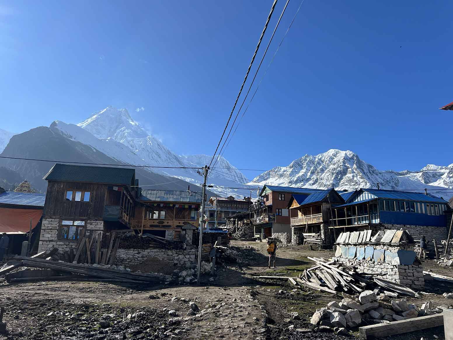
From Namrung, you continue through high alpine pastures and traditional stone settlements. Once at Lho, Mount Manaslu (8,163m) comes into view. This is your first close look at the world’s eighth-highest mountain, and you get a better sense of its size as you walk beneath it. You can also visit Ribung Monastery in Lho and hear the morning bells across the village.

Beyond Lho, the trail drops briefly into a forested ravine before climbing again toward Shyala. The village offers wide views of Himalchuli, Peak 29, and Manaslu, making it a good place to stop for lunch. In the afternoon, you follow a broad alpine valley as the Budhi Gandaki narrows into a smaller stream. Dry glacial moraine covers parts of the trail on the way to Samagaun. At 3,530 meters, the air feels colder and thinner. Once you reach the village, settle into your lodge and prepare for a two-night stay.

Itinerary Details
Itinerary Fact Details
Meals Icon
Meals
Breakfast, Lunch, Dinner
Accommodation Icon
Accommodation
Teahouse
Distance Icon
Trek Distance
17 km (10.9 miles)
Mountain Icon
Highest Altitude
3,530 m (11,106 ft)
Duration Icon
Trek Duration
6-7 hours

Day 12: Acclimatization Day at Samagaun

Samagaun gives you a full day to slow down and let your body adjust before the trail climbs higher toward the pass. You can choose the day’s activity according to your energy level. Option A (Birendra Tal) is the gentler choice, with a morning walk across rocky moraine toward the turquoise glacial lake below the Manaslu icefall. The lake sits beneath the surrounding mountain walls, and after visiting it, you return to Samagaun for a quieter afternoon.

For a more demanding day, Option B (Pungyen Gompa) and Option C (Manaslu Base Camp) take you higher into the mountains. The route climbs the grassy ridges above Samagaun, while Manaslu Base Camp reaches 4,800 meters. The thinner air calls for a slow, steady pace, and strong winds and cold temperatures become more noticeable higher up. At Base Camp, you can see tents used by international climbing expeditions, along with large seracs and ice fields. Whichever option you choose, you return to Samagaun in the afternoon for dinner and another night of rest.

Itinerary Details
Itinerary Fact Details
Meals Icon
Meals
Breakfast, Lunch, Dinner
Accommodation Icon
Accommodation
Teahouse
Distance Icon
Trek Distance
Varies (3 km to 12 km /1.8 to 7.4 miles)
Mountain Icon
Highest Altitude
3,530 m base up to 4,800 m (15,748 ft) at Manaslu Base Camp
Duration Icon
Trek Duration
3 to 8 hours depending on side trip

Day 13: Trek From Samagaun to Samdo

With Larkya La Pass getting closer, today’s walk is shorter and more relaxed. The morning sun takes time to reach Samagaun because of the large wall of Manaslu, so the village can still feel cold and shaded when you leave. The trail climbs gradually through dry terrain with low juniper bushes and alpine grass. It follows the smaller Budhi Gandaki stream as you move higher. At this altitude, each step takes more effort, and the wind becomes a regular part of the walk. You also pass old chortens and weathered stone structures along the way.

By late morning, you cross a wooden bridge over a side river, then make a short, steeper climb to Samdo. The village is home to Tibetan refugees and lies only a day’s walk from the actual border. Since you arrive before lunch, you have plenty of time to rest and drink fluids. Prayer flags move in the wind around the settlement, and you can hear yaks nearby. Later, your guide can take you on a short acclimatization walk up the ridge behind the village before you return for an early night.

Itinerary Details
Itinerary Fact Details
Meals Icon
Meals
Breakfast, Lunch, Dinner
Accommodation Icon
Accommodation
Teahouse
Distance Icon
Trek Distance
8 km (5 miles)
Mountain Icon
Highest Altitude
3,875 m (12,713 ft)
Duration Icon
Trek Duration
3-4 hours

Day 14: Trek From Samdo to Dharmasala

You leave Samdo with a short descent toward the final wooden bridge over the upper Budhi Gandaki. After crossing it, the river slowly falls behind as the trail turns toward the base of Larkya Pass. The route climbs across glacial moraine and open stone terrain. Trees and bushes disappear completely at this altitude, leaving mostly rock, ice, and sky. Shaded sections remain very cold, while the high-altitude sun provides some warmth as you keep walking.

By midday, you reach Dharmasala, also known as Larkya Phedi. Basic stone shelters provide a place for trekkers to rest before crossing the pass. Spend the afternoon resting, drinking plenty of hot water, and getting your gear ready for the early start. At 4,460 meters, the air is thin, and you may notice some pressure in your head or feel nervous about the pass ahead. Dinner is served early, around 05:00 PM, in the stone dining room. Afterward, get into your sleeping bag and try to get some rest for a big day tomorrow.

Itinerary Details
Itinerary Fact Details
Meals Icon
Meals
Breakfast, Lunch, Dinner
Accommodation Icon
Accommodation
High-Altitude Stone Shelter /Basic Lodge
Distance Icon
Trek Distance
8 km (5 miles)
Mountain Icon
Highest Altitude
4,460 m (14,632 ft)
Duration Icon
Trek Duration
4-5 hours

Day 15: Trek From Dharmasala to Bhimtang via Larkya Pass

Get ready for an early start because today is the longest and most demanding day of the trek. You leave Dharmasala around 04:00 AM, when temperatures are below freezing. Your headlamp provides most of your light as you start climbing across the Larkya Glacier moraine after a quick breakfast of porridge. The climb is long and steady, with snow and rocky ground underfoot. Keep a steady pace and focus on your breathing as you gain altitude. As daylight arrives, Cheo Himal and Himlung Himal gradually come into view.

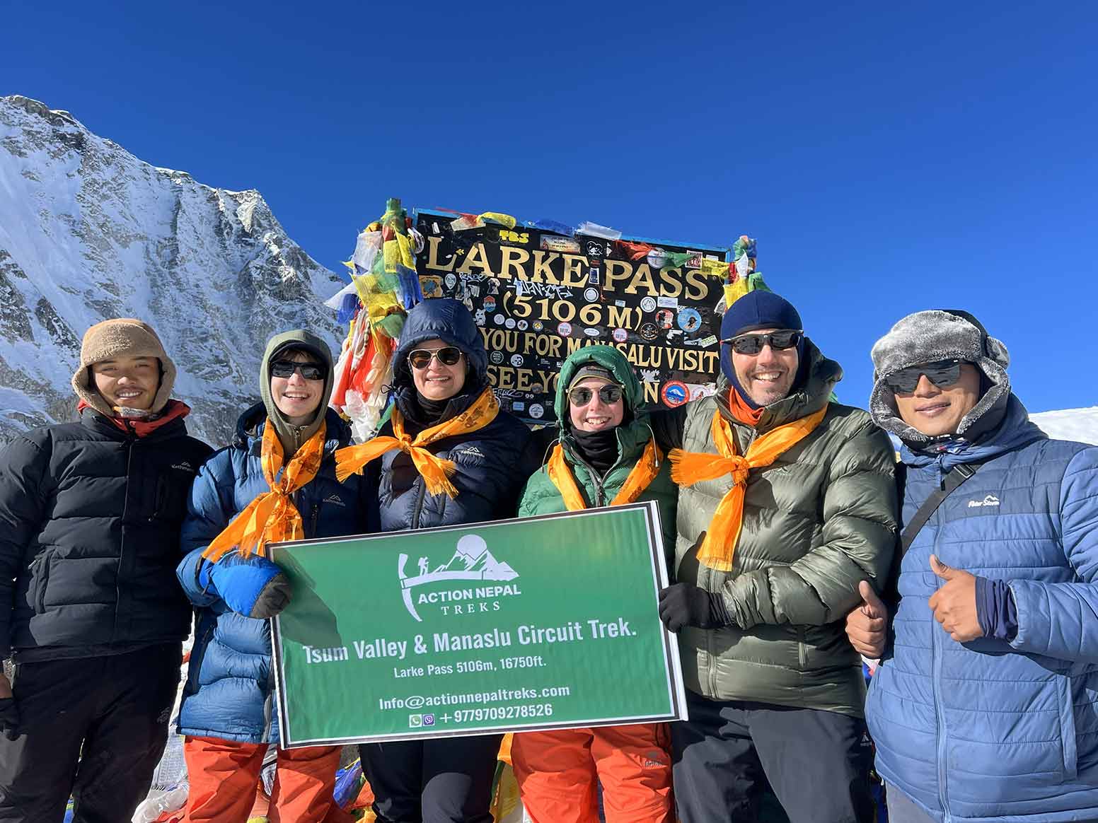
After several hours of climbing, you reach the prayer-flag-covered summit of Larkya La Pass (5,106m/ 16,782 ft). This is the highest point of the trek, with wide views across the central Himalaya. Take some time for photographs before beginning the long descent toward Bhimtang. The trail drops across loose scree and snow-covered slopes, which can strain your knees and quadriceps.

The descent continues for several hours, and the scenery changes as you lose altitude. The temperature rises, and the barren landscape gradually gives way to alpine meadows. By mid-afternoon, you reach the greener Bhimtang Valley. Check into your lodge, enjoy a hot meal, and finally rest after a long day on the trail.

Itinerary Details
Itinerary Fact Details
Meals Icon
Meals
Breakfast, Lunch, Dinner
Accommodation Icon
Accommodation
Teahouse
Distance Icon
Trek Distance
24 km (15 miles)
Mountain Icon
Highest Altitude
5,106 m (16,782 ft)
Duration Icon
Trek Duration
8-10 hours

Day 16: Trek From Bhimtang to Tilche Village

The change in scenery after Larkya Pass is hard to miss. You wake to views of the western face of Mount Manaslu before leaving the high meadows around Bhimtang. The trail soon enters forests of blue pine, oak, and rhododendron. After several days around rock, snow, and sparse alpine vegetation, thick greenery and the smell of damp earth tell you that you are losing elevation.

The route follows the Dudh Khola, or Milk River, through the forest, with maintained paths and wooden footbridges along the way. The thicker air makes the walk feel easier. Around midday, stop for lunch at a forest clearing near Karche, with birds and the river nearby. In the afternoon, you pass agricultural settlements such as Goa, where farmers grow crops including corn and millet on the terraces. The warmer weather means you can switch back to lighter clothing.

Later, you cross a major bridge over the Marsyangdi River and reach Tilche, a stone village along the classic Annapurna Circuit route. This is your final night on the trail. Enjoy dinner with your guide and porters, share stories from the trek, and celebrate completing the trekking section before heading back to Kathmandu the next day.

Itinerary Details
Itinerary Fact Details
Meals Icon
Meals
Breakfast, Lunch, Dinner
Accommodation Icon
Accommodation
Teahouse
Distance Icon
Trek Distance
24 km (15 miles)
Mountain Icon
Highest Altitude
3,720 m (12,204 ft)
Duration Icon
Trek Duration
6-7 hours

Day 17: Trek From Tilche to Besisahar, Then Drive to Kathmandu

On our final day, we will trek from Tilche to Besisahar, which takes about four to five hours. The trail will be relatively easy. It allows us to reflect on our incredible journey through the Manaslu and Tsum Valley.

Upon reaching Besisahar, we will arrange transportation back to Kathmandu, which takes around six to seven hours. Our drive will be scenic, and we will pass through many remote settlements along the far views of the Himalayas. Finally, our 17-day adventure will end, and our guide will take you to your hotel.

Itinerary Details
Itinerary Fact Details
Meals Icon
Meals
Breakfast, Lunch
Accommodation Icon
Accommodation
Hotel in Kathmandu (Self-Arranged)
Distance Icon
Trek Distance
2 km (1.2 miles)
Mountain Icon
Highest Altitude
2300 m (7546 ft)
Duration Icon
Trek Duration
45 minutes
Duration Icon
Drive Duration
230 km (142.9 miles)
Duration Icon
Drive Duration
8-9 hours total (2 hours jeep + 6-7 hours bus)

What's Included & Excluded in Manaslu Tsum Valley Trek

Includes

Excludes

  • Airport pickup and drop-off between Kathmandu’s international airport and your Kathmandu hotel
  • Licensed guide, including food, lodge, salary, insurance, and transport
  • One porter for every two trekkers, with food, lodge, salary, insurance, and transport covered. Solo guests who want a porter pay extra.
  • Porter load of 20 kg total, with 10 kg for each trekker
  • Breakfast, lunch, and dinner (main course) on trek days
  • 16 nights: 6/7 with an attached bath and 10/11 in a standard teahouse
  • Twin sharing (two beds, one room)
  • Shared ground transport from Kathmandu to Machha Khola and from Tilche to Besisahar to Kathmandu
  • Fruit after dinner and cookies as a light daily snack
  • An assistant guide when the group has more than six people
  • Water purification tablets
  • Sleeping bag, down jacket, duffel, poles, and crampons if required, all returned after the trek
  • All required trekking permits: Manaslu Restricted Area Permit, Tsum Valley Restricted Area Permit, MCAP, ACAP, and Chumnubri Rural Municipality Permit.
  • Entrance fees, taxes, and official charges on the itinerary
  • First aid kit with the team
  • Rescue coordination if we need to arrange an evacuation
  • Trip certificate from Action Nepal Treks
  • Farewell dinner in Kathmandu
  • International flights
  • Nepal visa
  • Kathmandu hotels and meals outside the itinerary, including extra nights from an early return, early arrival, or late departure
  • Personal extras, including hot showers, Wi-Fi, charging, drinks, alcohol, an extra porter, shopping, snacks, and your own clothing and gear
  • Travel insurance that must include helicopter evacuation
  • Tips for the guide and porter

Tsum Valley & Manaslu Circuit Trek Route Map

Explore the Trek Route in Google Satellite View for Better Clarity.

Trail
Return Trail

Why Tsum Valley Trek Via Manaslu Circuit Over Other Treks?

The Classic Tsum Valley Trek via Manaslu Circuit combines two very different parts of the Manaslu region in one trek. You spend time in the quieter Tsum Valley, return to the main Manaslu trail, and then continue toward Samagaun and across Larkya La Pass. Along the way, you experience mountain villages, Buddhist monasteries, changing landscapes, and a high-altitude pass in one 17-day itinerary.

Unique Cultural Experience

Tsum Valley adds a strong cultural side to the trek. The trail passes chortens, carved mani walls, monasteries, and traditional villages where farming and daily life remain closely connected. At Chumling, Chhekamparo, and Nile, you see stone houses and local traditions that reflect the valley’s close connection with Tibetan culture.

You also visit Mu Gompa and Anni Gompa, two important religious sites in the upper valley. The restricted-area route requires the necessary permits, and your guide can explain the local customs as you travel through the villages and visit religious sites. Combining the Tsum Valley and the Manaslu Circuit gives you more time to experience the region beyond the main trekking route.

Changing Mountain Landscapes

The scenery changes noticeably as you gain and lose altitude. The trek starts with river gorges, bamboo forests, and warmer lower valleys before moving through rhododendron forests and the alpine landscapes of Tsum Valley. Beyond Samagaun, the terrain becomes drier and more rugged as you approach Larkya Pass. After crossing the pass, the trail drops toward the greener meadows and forests around Bhimtang.

You also get views of several major Himalayan peaks along the route. Mount Manaslu (8,163m) comes into view around Lho and Samagaun, while the Tsum Valley trek offers views toward Ganesh Himal. Around Larkya La, you can see peaks including Himlung Himal, Cheo Himal, and Larkya Peak when weather conditions allow. The views come as part of the trek rather than from a single viewpoint.

A Quieter Trail Through Protected Areas

The Manaslu Tsum Valley Tre routes generally see fewer trekkers than Nepal’s busiest trekking areas. Restricted-area requirements, a longer approach, and the need for a licensed guide help keep the route quieter. However, the trail is not empty. You can still meet other trekking groups, especially around Samagaun and Larkya La during the busy seasons.

The itinerary also passes through both Manaslu Conservation Area (MCAP) and Annapurna Conservation Area (ACAP). These protected areas support a range of Himalayan wildlife. You may see animals such as Himalayan blue sheep (bharal) and birds of prey along the higher sections, although wildlife sightings depend on the season and conditions. The quieter setting also means simpler teahouses and fewer modern facilities than you find on more developed trekking routes.

A Flexible Acclimatization Day at Samagaun

The acclimatization day at Samagaun gives you several options instead of keeping everyone on the same schedule. You can choose a shorter walk to Birendra Tal, visit Pungyen Gompa, or take the more demanding hike toward Manaslu Base Camp (4,800m).

Your choice can depend on your energy, how you are adjusting to the altitude, and how much walking you want to do that day. This flexibility gives you time to explore more of the area while still leaving a full day for acclimatization before you continue toward Samdo and the higher sections of the trek.

A Challenging Trek With a High-Altitude Pass

This is a demanding trek, with long walking days and a highest point of 5,106m at Larkya La Pass. The trek involves several steep climbs and a long descent after crossing the pass. The highest sections can bring cold temperatures, thinner air, and more difficult trail conditions.

The standard itinerary does not require technical climbing or mountaineering. However, you need good physical preparation and enough time to adjust to the increasing altitude. The combination of Tsum Valley, the Manaslu Circuit, and Larkya La makes this a longer and more varied journey than simply following one section of the route. You get cultural sites, changing landscapes, high-mountain views, and a major Himalayan pass in the same trek.

What Is the Best Time to Do the Manaslu Tsum Valley Trek?

The best time to trek Manaslu Tsum Valley is generally spring (March to May) and autumn (September to November). These months bring more stable weather, better mountain visibility, and more suitable conditions for crossing the 5,106m Larkya La Pass.

Conditions still vary by altitude. Expect warmer weather in the lower valleys and much colder nights in the upper sections.

Spring (March to May)

Spring brings the beauty of the Manaslu region, along with warmer temperatures in the lower sections and blooming rhododendrons across parts of the Manaslu and Tsum Valley trails. The higher sections remain cold, and snow can still cover parts of the trail around Larkya La early in the season.

March can bring colder conditions and more lingering snow at higher elevations. By April and May, temperatures become more comfortable, and the lower valleys become greener. Morning skies often offer good mountain views, although clouds can build later in the day.

Autumn (September to November)

Autumn follows the summer monsoon and generally brings cooler, drier conditions and clearer mountain views. September can still see some rain, particularly early in the month, while October and November usually bring more settled trekking conditions.

The lower sections feel comfortable during the day, while nights become increasingly cold as you climb. Upper villages such as Samdo (3,860m) and Dharmasala (4,460m) can feel particularly cold, so warm layers and a good sleeping bag are essential.

Autumn also brings more trekkers to the Manaslu region. Teahouses can therefore feel busier, particularly around popular stops and the Larkya La crossing.

Summer and Monsoon (June to August)

The monsoon brings frequent rain to the lower sections of the trek. Trails can become wet and muddy, while leeches may appear in forested areas. Heavy rain can also increase the risk of landslides and affect road and trail conditions.

Cloud cover often limits mountain views during this period. Conditions become more unpredictable as you approach the higher sections, so check current trail and weather conditions before planning a monsoon trek.

Winter (December to February)

Winter brings cold, snow, and shorter trekking days to the Manaslu region. Temperatures drop sharply at higher elevations, and snow can make sections around Larkya La Pass difficult to cross.

Some higher teahouses may also close during the coldest part of winter, particularly in remote areas. This can make accommodation and food logistics harder than in spring or autumn.

If you plan to trek in winter, check the current pass, trail, weather, and lodge conditions with your trekking agency before departure. The full Manaslu Tsum Valley route requires a successful crossing of Larkya La, so conditions at the pass play a major role in whether the itinerary can operate safely.

How Difficult Is the Manaslu Tsum Valley Trek?


tsum valley trek distance

The Manaslu Tsum Valley Trek is a strenuous, high-altitude trek that combines long walking days, steep ascents and descents, remote trails, and a crossing of Larkya La Pass at 5,106m (16,752ft). You spend several days above 3,000m and reach elevations where altitude becomes a major part of the challenge.

The difficulty comes from several factors:

  • Steep and varied terrain: The trail moves from river gorges and stone staircases to forest paths, rocky sections, alpine meadows, and glacial moraine.
  • High altitude: You sleep at elevations above 3,500m and reach 5,106m at Larkya La Pass. The thinner air makes even steady walking more tiring.
  • Long trekking days: Most days involve around 5-7 hours of walking, while the Larkya La crossing takes around 8-10 hours.
  • Remote conditions: Upper Tsum Valley and the Manaslu Circuit have basic teahouses, limited services, and fewer medical facilities than popular trekking areas.
  • Larkya La Pass: You start early from Dharmasala, climb through high-altitude terrain, cross the pass, and then make a long descent to Bhimtang.

You do not need mountaineering or technical climbing experience for the standard trek. However, you should feel comfortable hiking for several consecutive days on steep, uneven terrain.

Is the Manaslu Tsum Valley Trek Suitable for Beginners?

The trek is not the easiest choice for a first Himalayan trek, mainly because of its length, altitude, remote setting, and demanding pass day. Previous multi-day hiking experience can make the transition easier, but you don’t need to be an experienced mountaineer.

If you are new to high-altitude trekking, prepare well before the trek. Build your walking endurance, train on hills or stairs, and get used to carrying a daypack. Your guide also controls the pace and helps you follow the itinerary safely as you gain altitude.

Your ability to handle the trek depends more on consistent endurance, preparation, and altitude management than on speed or athletic performance.

How Fit Do You Need to Be?

You should have good cardiovascular endurance and strong legs before starting the trek. Focus your preparation on walking for several hours, climbing stairs or hills, and handling repeated uphill and downhill sections.

If you currently have a low level of hiking fitness, start training 2-3 months before the trek. If you already hike regularly, focus on increasing your distance, elevation gain, and consecutive walking days. A useful training routine includes:

  • Walking and hiking: Build toward longer walks on uneven and uphill terrain.
  • Stair and hill training: Practice sustained climbs to prepare for the many stone steps on the trail.
  • Leg strength: Include squats, lunges, step-ups, and calf raises to strengthen your legs.
  • Pack training: Gradually walk with a daypack so your body gets used to carrying your trekking essentials.
  • Recovery: Include rest days between harder training sessions so you arrive at the trail fresh rather than already fatigued.

Which Is Harder: Tsum Valley or the Manaslu Circuit?

Both sections have steep and uneven trails, but the Manaslu Circuit becomes more demanding as the route gains altitude and approaches Larkya La Pass. Tsum Valley reaches around 3,700m at Mu Gompa, while the Manaslu section reaches 5,106m at Larkya La.

Feature Tsum Valley Manaslu Circuit
Highest point 3,700m (Mu Gompa) 5,106m (Larkya La Pass)
Typical walking time 4-7 hours per day 5-10 hours per day
Terrain Forested gorges, stone steps, narrow valley trails, and steep climbs Rocky trails, alpine terrain, moraine, and high-pass sections
Altitude challenge Moderate, with gradual altitude gain toward Mu Gompa Greater, with several nights above 3,500m and the Larkya La crossing
Main challenge Steep climbs and repeated ascents and descents Higher altitude, longer days, and the Larkya La Pass crossing

Tsum Valley gives you several days to gain altitude and adjust to the mountain environment before you return to the main Manaslu route. The biggest physical challenge comes later, when you climb toward Dharmasala, cross Larkya La Pass, and descend to Bhimtang.

Overall, the trek demands steady endurance rather than technical climbing ability. Good preparation, a sensible pace, and proper acclimatization make a significant difference on the trail.

Can You Trek the Manaslu Tsum Valley Trek Solo?

Yes. Since March 22, 2026, solo trekkers can apply for the required restricted-area permit without finding a second trekker. The previous minimum-two-trekker requirement no longer applies to the restricted-area permit.

However, solo does not mean unguided. You must still trek with a licensed trekking guide, and you must process the permit through a registered Nepali trekking agency. In practice, a solo trek means you can travel as the only client with your own guide. You don’t have to join another trekker just to meet the old permit requirement (minimum 2 trekkers).

This change gives solo travelers more flexibility when planning the Manaslu Tsum Valley Trek. You no longer need to find another foreign trekker just to qualify for the restricted-area permit, but you still need the required permits, agency support, and a licensed guide.

Documents You Need to Provide

Before we apply for your permits, please provide:

  • Passport copy
  • Valid Nepal visa
  • Passport-style photograph
  • Travel insurance documents with the required coverage for the trek
  • Your trekking itinerary and personal details

We handle the permit applications and carry the required permits during the trek. Immigration officials or police may check the restricted-area permits at checkpoints along the route.

Note: Permit fees and local entry charges can change. We confirm the current rates with you before departure.

What Altitude Should You Expect on the Manaslu Tsum Valley Trek, and How Can You Prevent Altitude Sickness?

The Manaslu Tsum Valley Trek starts at 930m in Machha Khola and reaches its highest point at Larkya La Pass (5,106m / 16,752ft). The route gains altitude gradually, but you spend several nights above 3,000m before reaching the high-altitude sections of the Manaslu Circuit. Proper pacing, acclimatization, hydration, and awareness of altitude sickness symptoms all matter as you climb.

Altitude Progression and Key Milestones

Section Key stops and altitude What to expect
Lower Manaslu Machha Khola (930m) to Jagat (1,340m) Lower elevations with warmer, more humid conditions
Tsum Valley Chhekamparo (3,031m) to Mu Gompa (3,700m) Noticeably thinner air as you climb higher into the valley
Return to the Manaslu Circuit Chumling to Namrung (2,660m) The trail drops before climbing again toward the upper Manaslu region
Upper Manaslu Samagaun (3,530m) to Samdo (3,860m) Higher altitude, colder conditions, and slower walking pace
High-altitude section Dharmasala (4,460m) Very thin air and cold conditions before the pass
Highest point Larkya La Pass (5,106m) The highest and most demanding point of the trek

Altitude Sickness and What to Watch For

Acute Mountain Sickness (AMS) can occur when you ascend faster than your body can adapt to the lower air pressure at altitude. Common symptoms include headache, nausea, dizziness, tiredness, loss of appetite, and difficulty sleeping.

More serious symptoms require immediate action. Confusion, difficulty walking or maintaining balance, severe shortness of breath at rest, or a worsening cough can indicate a serious altitude-related illness and require urgent descent and medical attention.

Here are some ways to prevent altitude sickness on the Manaslu Trek with the Tsum Valley:

  • Ascend gradually: Follow the itinerary and give your body time to adjust as you gain elevation.
  • Pace yourself: Walk slowly at higher elevations and avoid unnecessary bursts of hard effort.
  • Stay hydrated: Drink regularly throughout the day and replace fluids lost through exertion and dry mountain air.
  • Eat properly: Continue eating regular, carbohydrate-rich meals even when your appetite decreases.
  • Avoid alcohol: Alcohol can worsen dehydration and interfere with sleep, so avoid it at higher elevations.
  • Use acclimatization walks wisely: Follow your guide’s planned acclimatization walks and return to a lower sleeping altitude when the itinerary calls for it.

When Should You Descend?

Do not continue climbing when altitude sickness symptoms are worsening. If symptoms do not improve after resting at the same altitude, speak with your guide and consider descending. Severe symptoms such as confusion, loss of coordination, or breathing difficulty at rest require immediate descent and urgent medical attention.

Your guide or trek leader can monitor your condition during the trek, but a guide cannot replace medical care. If you have a medical condition, take regular medication, or plan to use acetazolamide (Diamox) for altitude sickness prevention, speak with a qualified medical professional before the trek.

What Food and Accommodation Can You Expect on the Manaslu Tsum Valley Trek?

The Manaslu Tsum Valley Trek uses teahouses and local lodges throughout the 17-day journey. The package includes breakfast, lunch, and dinner on trek days, plus fruit after dinner, cookies, and water purification tablets. Accommodation and food choices become simpler as you move into higher and more remote sections.

Accommodation on the Manaslu Tsum Valley Trek

local resturant at philim

You stay in twin-sharing rooms with two beds rather than camping in tents. The facilities vary along the route, with more basic conditions at higher elevations.

Trek section Main stops Accommodation & facilities
Lower Manaslu Machha Khola to Deng Twin-sharing teahouses /local lodges; attached or shared bathrooms
Tsum Valley Lokpa to Nile Twin-sharing teahouses /local lodges; attached or shared bathrooms
Upper Manaslu Samagaun to Samdo Twin-sharing teahouses /local lodges; mostly shared bathrooms
High altitude Dharmasala Basic lodge/stone shelter; very basic facilities
After Larkya Pass Bhimtang to Tilche Twin-sharing teahouses /local lodges; attached or shared bathrooms

The trek includes 16 nights of trail accommodation (Your Kathmandu hotel is self-arranged and does not form part of the trail accommodation). Of these, 6 to 7 nights have attached bathrooms, while 10 to 11 nights use shared bathrooms. Dharmasala (4,460m) is the most basic overnight stop, where you stay before the early crossing of Larkya La Pass. We also provide a sleeping bag for the colder nights.

Hot showers, Wi-Fi, and electronic charging are not included and count as personal expenses. Availability varies between lodges, particularly in the higher sections.

Food on the Manaslu Tsum Valley Trek

food at tsum valley trek

The package covers breakfast, lunch, and dinner on all trek days. Teahouses prepare meals along the route, so the choice changes with the location and altitude.

Trek section Main stops Breakfast Lunch & Dinner
Lower Manaslu Machha Khola to Deng Porridge, eggs, pancakes Dal Bhat, noodles, momos, rice dishes, soups
Tsum Valley Lokpa to Nile Porridge, eggs, pancakes Dal Bhat, noodles, momos, soups
Upper Manaslu Samagaun to Samdo Simple breakfast options Dal Bhat, noodles, rice dishes, soups
High altitude Dharmasala Basic breakfast, hot drinks Simple meals, soups, hot drinks
After Larkya Pass Bhimtang to Tilche Simple breakfast options Dal Bhat, noodles, rice dishes, teahouse meals

Dal Bhat is one of the most common meals on the trek. It usually includes rice, lentil soup, vegetables, and pickles. Lower sections generally offer more choices, including noodles, fried rice, momos, soups, porridge, pancakes, and eggs. As you gain altitude, menus become shorter and meals simpler.

We also provide fruit after dinner and cookies as a light daily snack as part of our package. Drinks, alcohol, and additional snacks are personal expenses.

Drinking Water

You can refill your bottles at teahouses, lodges, village taps, and other local water sources along the trail. Streams and springs also provide water in some sections, but you should always treat water before drinking it. We’ll provide water purification tablets, so carry reusable bottles and use the tablets as your guide instructs. Teahouses may also provide boiled drinking water for an additional charge.

If you have food allergies or dietary restrictions, tell us before departure so we can plan your meals for the more remote sections of the trek.

What Permits Are Required for the Manaslu Tsum Valley Trek?

The Manaslu Tsum Valley Trek requires several permits because the route passes through restricted areas and both the Manaslu and Annapurna conservation areas. We arrange the required permits before you start.

For this 17-day itinerary, the required permits are:

  • Manaslu Restricted Area Permit (RAP)
  • Tsum Valley Restricted Area Permit
  • Manaslu Conservation Area Permit (MCAP)
  • Annapurna Conservation Area Permit (ACAP)
  • Chumnubri Rural Municipality entry fee

The Department of Immigration issues restricted-area permits, and you must arrange them through a registered trekking agency.

Manaslu Restricted Area Permit

The Manaslu Restricted Area Permit (RAP) covers the restricted section of the Manaslu region within Chumnubri Rural Municipality. The fee depends on the season and the number of days the permit covers.

Season First 7 Days Each Additional Day
Sept-Nov USD 100 USD 15
Dec-Aug USD 75 USD 10

Tsum Valley Restricted Area Permit

The Tsum Valley Restricted Area Permit is separate from the Manaslu RAP. You need it because this itinerary enters the restricted Tsum Valley before rejoining the main Manaslu Circuit.

Season Permit Fee
Sept-Nov USD 40 per person for the first 7 days, then USD 7 per additional day
Dec-Aug USD 30 per person for the first 7 days, then USD 7 per additional day

Manaslu Conservation Area Permit (MCAP)

The Manaslu Conservation Area Permit (MCAP) covers entry into the Manaslu Conservation Area. The current fee is:

  • Foreign nationals: NPR 3,000 per person
  • SAARC nationals: NPR 1,000 per person
  • Nepali nationals: NPR 100 per person

This fee is separate from the Manaslu Restricted Area Permit.

Annapurna Conservation Area Permit (ACAP)

You also need an Annapurna Conservation Area Permit (ACAP) because the route enters the Annapurna Conservation Area after crossing Larkya La and continues toward Dharapani and Besisahar.

The current fee is:

  • Foreign nationals: NPR 3,000 per person
  • SAARC nationals: NPR 1,000 per person
  • Nepali nationals: NPR 100 per person

Chumnubri Rural Municipality Entry Fee

The route passes through Chumnubri Rural Municipality, which also collects a local entry fee. Confirm the current amount with your trekking agency before departure, as local charges can change.

The current fee is:

  • All Foreigners: NPR 1,000 (approx. USD 8)

Why Book With Action Nepal Treks?

We are a local Kathmandu-based trekking operator specializing in journeys through Nepal’s Himalayan regions. For the Manaslu Tsum Valley Trek, our team handles the practical arrangements before you set out and supports you throughout the trail.

  • Local expertise: Our Nepalese guides know the Manaslu Tsum Valley routes, including their remote sections and changing trail conditions.
  • Permit handling: We arrange the restricted-area, conservation, and local permits required for this itinerary.
  • Complete trekking support: Our trek package includes a licensed guide, porter support, teahouse accommodation, meals, and ground transport as listed in the inclusions.
  • Emergency coordination: Our team carries a first aid kit and can coordinate evacuation support if an emergency occurs.
  • Solo and private options: Solo trekkers can ask about available group arrangements or choose a private departure.
  • Direct communication: Contact our Kathmandu office to confirm your dates, availability, current price, and trip arrangements.

See our booking information for the required documents and booking steps, or contact us directly to start planning your trek.

Dates & Prices

Our fixed departure dates and per-person pricing make it simple for both solo travelers and small groups to join the adventure. It’s a great chance to meet new people and share the experience with other trekkers. Just choose your preferred date, and we’ll take care of the rest.

Manaslu Tsum Valley Trek Departure Date

Start Monday

21 Sep

Status

Booking Open

Days

17

Per Person

USD 1,299

Manaslu Tsum Valley Trek

Start Monday

21 Sep

Status

Booking Open

Days

17

Per Person

USD 1,299

Manaslu Tsum Valley Trek

Start Wednesday

23 Sep

Status

Booking Open

Days

17

Per Person

USD 1,299

Manaslu Tsum Valley Trek

Start Friday

25 Sep

Status

Booking Open

Days

17

Per Person

USD 1,299

Manaslu Tsum Valley Trek

Start Sunday

27 Sep

Status

Booking Open

Days

17

Per Person

USD 1,299

Manaslu Tsum Valley Trek

Start Monday

28 Sep

Status

Booking Open

Days

17

Per Person

USD 1,299

Manaslu Tsum Valley Trek

Start Monday

28 Sep

Status

Booking Open

Days

17

Per Person

USD 1,299

Manaslu Tsum Valley Trek

Start Wednesday

30 Sep

Status

Booking Open

Days

17

Per Person

USD 1,299

Manaslu Tsum Valley Trek

What to Pack for the Manaslu Tsum Valley Trek?

The Manaslu Circuit Tsum Valley Trek takes you from warm, humid river valleys to cold alpine terrain and the 5,106m Larkya La Pass. Your packing needs to cover both extremes without making your bags unnecessarily heavy.

Before You Pack

We provide a duffel bag for porter transport, with a maximum load of 10 kg per trekker. You carry your personal essentials in your daypack each day. Pack in layers so you can adjust easily as temperatures change. Keep important items such as your passport, money, medications, rain gear, warm layer, and personal electronics in your daypack.

Our package also provides a sleeping bag, down jacket, duffel bag, trekking poles, and crampons if required. We collect these items after the trek, so you do not need to bring your own unless you prefer to use personal gear.

boot
Clothing
sleeping bag
trekking Gear
sunscreen (1)
powerbank

Bags

  • Daypack (25-35L): Carry water, snacks, rain gear, a warm layer, camera, documents, and other daily essentials.
  • Duffel bag: Use the duffel we provide for clothing and other gear carried by the porter.
  • Waterproof pack cover: Protect your daypack during rain or snow.

Footwear

  • Trekking boots: Choose broken-in boots with good grip and water resistance. Avoid wearing new boots on the trek.
  • Camp shoes or sandals: Useful for relaxing at the teahouse after a long walking day.
  • Trekking socks (4-5 pairs): Choose wool or synthetic moisture-wicking socks.
  • Warm socks (2 pairs): Keep one or two pairs dry for cold nights and the Larkya La crossing.

Clothing

Use a simple layering system so you can add or remove clothing as you move between lower valleys and high-altitude sections.

Upper Body

  • Thermal base layers (2-3): Long-sleeve layers for cold mornings and higher elevations.
  • Trekking shirts (3-4): Lightweight, quick-drying shirts for warmer sections.
  • Fleece or warm mid-layer: For cool mornings and evenings.
  • Warm down jacket: Important for high-altitude nights and the early start for Larkya La. We provide a down jacket as part of the package.
  • Waterproof and windproof shell: A reliable outer layer for rain, snow, and strong wind.

Lower Body

  • Thermal base layers (2 pairs): Useful for cold nights and the pass day.
  • Trekking pants (2 pairs): Choose lightweight, quick-drying trousers.
  • Warm trekking or fleece pants (1 pair): For higher elevations.
  • Waterproof shell pants: Useful in rain, snow, and exposed sections around the pass.

Head and Hands

  • Sun hat or cap: Protects your face from strong mountain sunlight.
  • Warm beanie: Choose one that covers your ears.
  • Liner gloves: Useful for cooler mornings and daily trekking.
  • Warm outer gloves or mittens: Important for the cold conditions around Larkya La.

Sleeping Gear

  • Sleeping bag: We provide one as part of the package. You can bring your own if you prefer a personal sleeping bag suited to high-altitude conditions.
  • Sleeping bag liner: Optional, but useful for extra warmth and hygiene.

Trekking Gear

  • Trekking poles: We provide poles as part of the package. They can help with steep ascents and reduce strain during the long descent from Larkya La.
  • Crampons: We provide them if conditions require them. Your guide will advise you based on the trail conditions.
  • Headlamp: Bring one with spare batteries. You will need it for the early morning start on pass day.
  • Sunglasses: Choose good-quality UV-protection sunglasses for strong sunlight and snow glare.
  • Water bottles or hydration bladder: Bring reusable bottles with enough capacity for your daily needs. Water refilling and purification are covered in the accommodation and food section.

Toiletries and Personal Care

  • Sunscreen: SPF 50+ is a practical choice for strong mountain sunlight.
  • Lip balm: Helps protect your lips from dry, cold air.
  • Quick-dry towel: Useful for lodge stays and showers.
  • Wet wipes: Helpful when showers are limited or unavailable.
  • Toiletries: Carry travel-size soap, toothbrush, toothpaste, and other personal essentials.
  • Personal medications: Bring any regular medication you need throughout the trek.

First Aid and Health Essentials

Carry a small personal first-aid kit even though our team carries a first-aid kit during the trek.

  • Blister treatment
  • Pain reliever
  • Rehydration salts
  • Any regular prescription medication
  • Personal altitude medication, if prescribed or recommended by your doctor

For altitude medication such as acetazolamide (Diamox), speak with a qualified medical professional before the trek rather than starting it on your own.

Electronics and Documents

  • Power bank (10,000-20,000mAh)
  • Phone and camera
  • Charging cables
  • Passport
  • Insurance documents
  • Nepali cash

FAQs for Tsum Valley Trek

Traveler Feedback on the Manaslu Tsum Valley Trek

Action Nepal Treks is a reliable trekking company run by a professional guide who has been active in Nepal’s tourism industry for 15 years.

Verified

Best Company so Far !

Amazing Experience:)!! We did the Manaslu & Tsum Valley track 18-19 days ! Good Communication ! Excellent Service ! Simbir & Umesh are really nice guys and did a perfect job ! This Guys are Stunning ! Thanks ❤️❤️❤️

Verified

Best Company so Far !

Amazing Experience:)!! We did the Manaslu & Tsum Valley track 18-19 days ! Good Communication ! Excellent Service ! Simbir & Umesh are really nice guys and did a perfect job ! This Guys are Stunning ! Thanks ❤️❤️❤️

Verified

Thank you very much

My three friends and I had the pleasure to go hiking with Umesh from Action Nepal Treks. We wanted to start with the Tsum Valley Trek as a couple and then the other two meetings to go with them the Manaslu circuit. The organization was perfectly planned and even our special planning had been implemented without any problems. Umesh is...

Verified

Thank you very much

My three friends and I had the pleasure to go hiking with Umesh from Action Nepal Treks. We wanted to start with the Tsum Valley Trek as a couple and then the other two meetings to go with them the Manaslu circuit. The organization was perfectly planned and even our special planning had been implemented without any problems. Umesh is professional, warm, well equipped, and very entertaining. If there was any point that would have been expandable, I would have loved to have been told a little more information about the places we visited and the culture that is lived there. Of course, you can also read this yourself or ask. Finally, Action Nepal Treks showed us transparency, honesty, kindness, trust, and patience. Thank you very much for this experience.

Verified

Tsum Valley + Manaslu Circuit

We were 4 guys from Germany and we’ve chosen „action Nepal treks“ for our first Himalayan adventure and can’t be happier after completing Tsum valley and manaslu circuit. Communication in advance was perfect and very easy via WhatsApp and Instagram. The companies owner Simbir arranged the whole trip and was very flexible and offered an competitive price! We got a...

Verified

Tsum Valley + Manaslu Circuit

We were 4 guys from Germany and we’ve chosen „action Nepal treks“ for our first Himalayan adventure and can’t be happier after completing Tsum valley and manaslu circuit. Communication in advance was perfect and very easy via WhatsApp and Instagram. The companies owner Simbir arranged the whole trip and was very flexible and offered an competitive price! We got a full package including accommodation, transportation and food, and would highly recommend that option. During the trip our guides Rick and Umesh supported us in any way, took amazing fotos of the group, joined us for card games and shared jokes all day long. Over all a great company with amazing guides! Would always choose them again!

Verified

Manaslu Trek with Simbir and Action Nepal Treks

Simbir and Action Nepal Treks were amazing! We did the Manaslu circuit this November and had the best time. It began with Simbir picking us up from the airport. He was so friendly and easy to communicate with right of the bat. He made sure before we left we had all the right equipment, as it had just snowed and...

Verified

Manaslu Trek with Simbir and Action Nepal Treks

Simbir and Action Nepal Treks were amazing! We did the Manaslu circuit this November and had the best time. It began with Simbir picking us up from the airport. He was so friendly and easy to communicate with right of the bat. He made sure before we left we had all the right equipment, as it had just snowed and we now needed crampons. You can tell Simbir is very competent and experienced as a guide. The next day, we met up with Kanxa Dai, our porter, who was immediately so nice and such a warm person to be around. When we began the trek, Simbir always made sure we had enough food and stopped for snacks/drinks. After the storms the trail had washed out in places and with Simbir’s guidance we never felt unsafe at any point. Throughout the trek we learned so much about Nepalese culture from Simbir and Kanxa Dai. But not only that it, felt like we were hiking with friends. Overall, it was such a memorable experience and we already want to come back and trek with Simbir and Kanxa Dai again. I would highly recommend Action Nepal Treks to anyone looking for a guiding company!

Verified

Manaslu Winter Circuit

If I could give 10 stars I would! I’m a 20 yer old female who has never done backpacking, hiking over 13 miles, less alone traveled to Nepal. I was a total beginner going into this, I didn’t know what I was getting into. I was also traveling in a small group of 5 women, including myself. However, going on...

Verified

Manaslu Winter Circuit

If I could give 10 stars I would! I’m a 20 yer old female who has never done backpacking, hiking over 13 miles, less alone traveled to Nepal. I was a total beginner going into this, I didn’t know what I was getting into. I was also traveling in a small group of 5 women, including myself. However, going on the Manaslu trek with Simbir and Action Nepal Treks was the BEST decision ever. I felt so safe, taken care of with all my needs, Simbir and his team were SO supportive and took care all of us so well, before the trek, during the trek, and after the trek. You can tell Simbir takes extreme care of his clients. Him and his team made this trip so special for all of us! We laughed, danced, shared stories and connected so much aside from the trek itself. He is great at sharing the culture and history of Nepal as your trekking too! If I can do this all over, even as a solo female traveler, I 100% would!! Simbir is the best and I’m so grateful for the time we had together!

Similar Trips

Join us on similar trips in the same region

View Details
ruby valley himalaya

Ruby Valley Trek

View Details
Tsum Valley

11 days Tsum Valley Trek

View Details
Trekkers at larke la pass

Manaslu Circuit Trek

USD 1,299/ pp